 geocatalogue.geoportail.lu
Demography>Total population
Type of resources
Available actions
Topics
Keywords
Contact for the resource
Provided by
Groups
Years
Representation types
Update frequencies
status
Scale
-

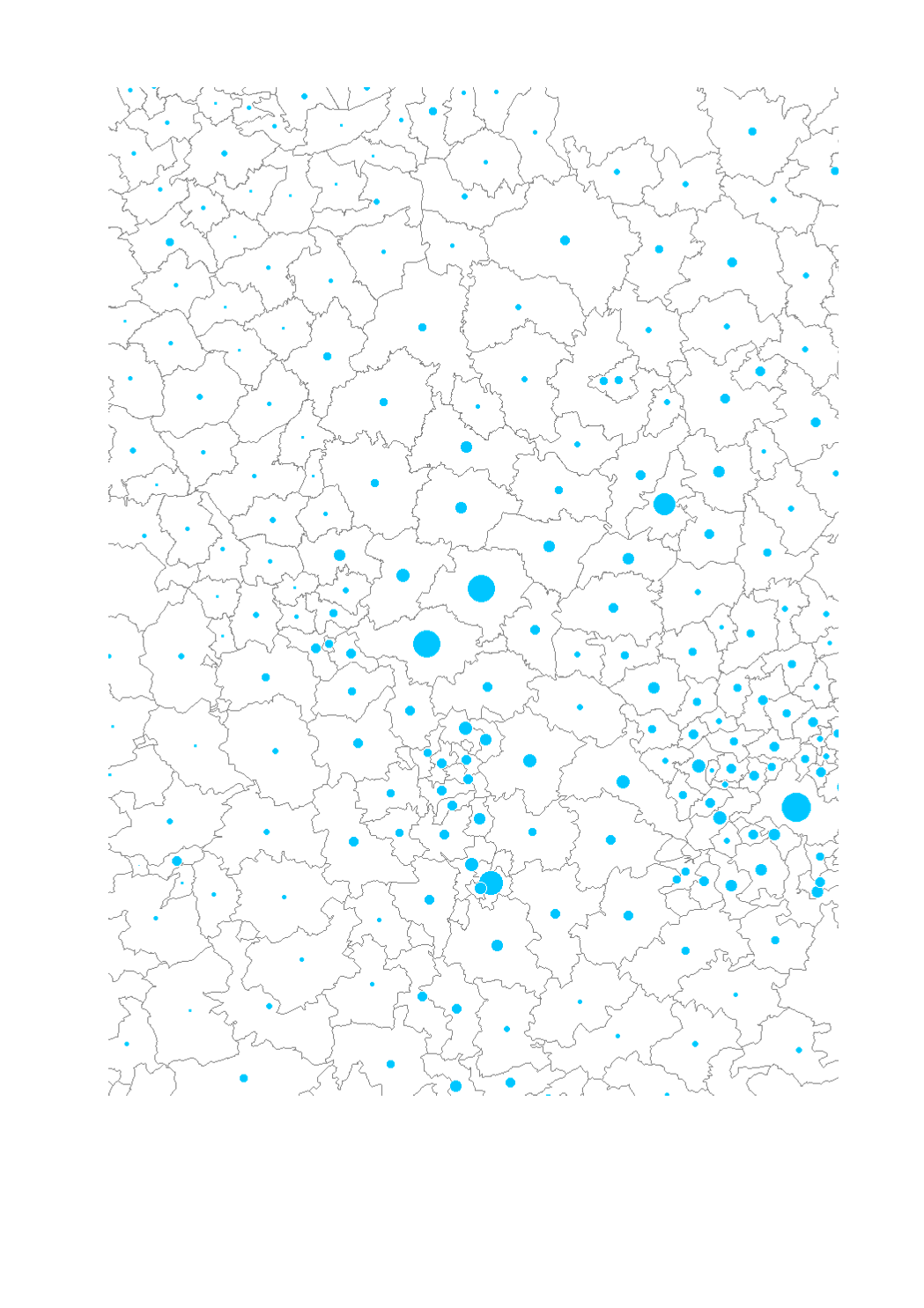
Total population 2007 by municipality - Statistical data sources: INSEE Lorraine; IWPEPS; STATEC; Statistisches Landesamt Rheinland-Pfalz; Statistisches Amt Saarland. - Geodata sources: EuroGeographics EuroRegionalMap v3.0 - 2010. Harmonization: SIG-GR / GIS-GR 2012
-
Total population 2010 by aggregated areas - Territorial entities: municipalities (Wallonie, Saarland), cantons (Lorraine, Luxembourg), Verbandsgemeinden (Rheinland-Pfalz) - Statistical data sources: INSEE Lorraine; IWPEPS; STATEC; Statistisches Landesamt Rheinland-Pfalz; Statistisches Amt Saarland. - Geodata sources: EuroGeographics EuroRegionalMap v3.0 - 2010. Harmonization: SIG-GR / GIS-GR 2014
-
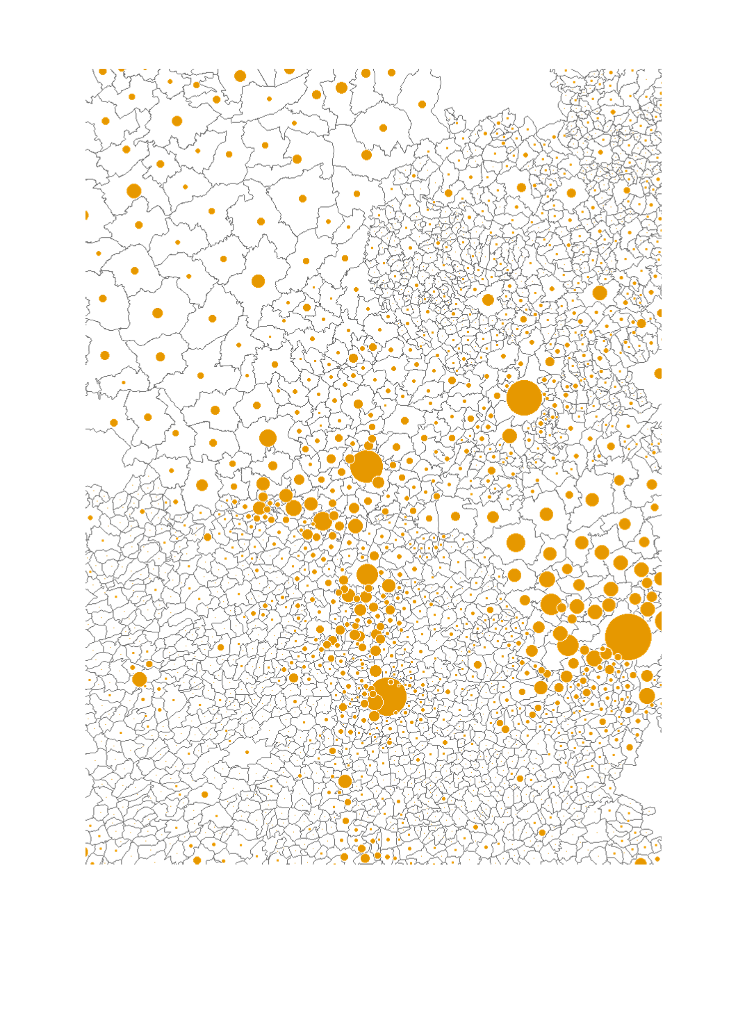
Total population 2010 by municipality - Statistical data sources: INSEE Lorraine; IWPEPS; STATEC; Statistisches Landesamt Rheinland-Pfalz; Statistisches Amt Saarland. - Geodata sources: EuroGeographics EuroRegionalMap v3.0 - 2010. Harmonization: SIG-GR / GIS-GR 2014